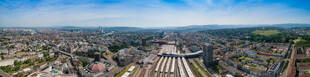
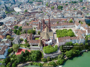
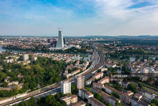
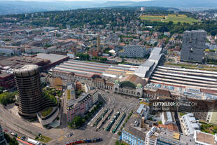
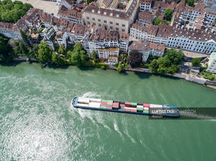
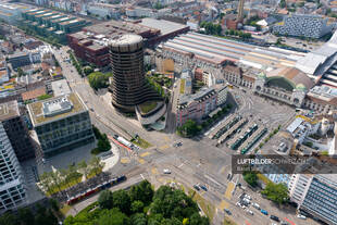
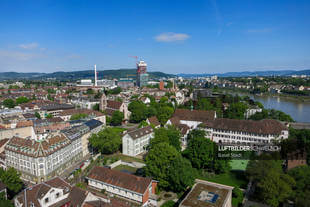
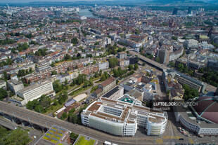
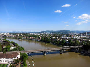
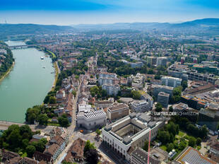
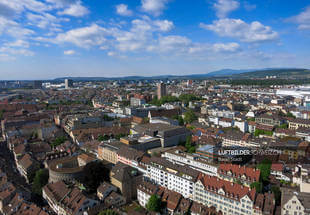
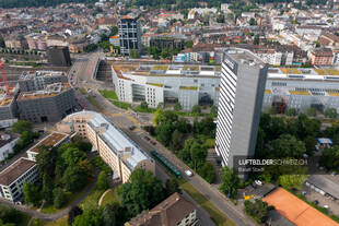
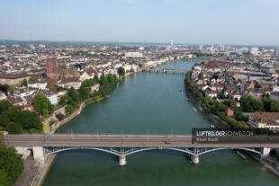
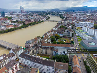
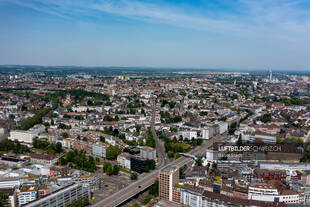
StartLuftaufnahmen der SchweizOrtschaftenBasel StadtLuftbild Höhenweg Stadt Basel «Basler Münster Luftbild» wurde Ihrem Warenkorb hinzugefügt. Warenkorb anzeigen Luftbild Höhenweg Stadt Basel49.95CHF Luftbild Höhenweg Stadt Basel Menge Lizenz kaufen Bildgrösse / Format 4856 x 3640 Pixel / JPG (DNG auf Anfrage) Kategorien Basel Stadt, Ortschaften, Städte Keywords Basel Stadt, Drohne, Innenstadt, Kanton Basel, Luftaufnahme, Luftbild, Schweiz, Stadt, Stadt Basel, Beschreibung Beschreibung Diese Drohnenaufnahme zeigt die Margarethenstrasse hinter dem Hauptbahnhof der Stadt Basel. Weitere Luftbilder zu Basel Stadt Basel StadtPanorama Panorama Luftbild Basel Stadt Buy now Panorama Luftbild Basel Stadt Basel Stadt Luftbild Basler Münster Buy now Luftbild Basler Münster Basel Stadt Luftaufnahme Basel Gellert / Breite Buy now Luftaufnahme Basel Gellert / Breite Basel Stadt Drohnenfoto Basel Centralbahnplatz Buy now Drohnenfoto Basel Centralbahnplatz Basel StadtWasser Luftbild Wassertransport Rhein Stadt Basel Buy now Luftbild Wassertransport Rhein Stadt Basel Basel Stadt Basel Luftaufnahme Nauenstrasse Buy now Basel Luftaufnahme Nauenstrasse Basel StadtSommer Luftaufnahme Basel Wettstein-Quartier Buy now Luftaufnahme Basel Wettstein-Quartier Basel Stadt Basel Luftbild Markthalle Buy now Basel Luftbild Markthalle Basel StadtBrückenSommerWasser Luftaufnahme Basel Wettsteinbrücke Buy now Luftaufnahme Basel Wettsteinbrücke Basel Stadt Kunstmuseum Basel Luftbild Buy now Kunstmuseum Basel Luftbild Basel StadtSommer Luftaufnahme Basel Altstadt Buy now Luftaufnahme Basel Altstadt Basel Stadt Basel Münchensteinerstrasse Luftbild Buy now Basel Münchensteinerstrasse Luftbild Basel Stadt Luftbild Basel Rheinbrücke Buy now Luftbild Basel Rheinbrücke Basel Stadt Basel Luftbild Rhein Spitalstrasse Buy now Basel Luftbild Rhein Spitalstrasse Basel Stadt Basel Luftaufnahme Heuwaage-Viadukt Buy now Basel Luftaufnahme Heuwaage-Viadukt